World

Atlas

land: 241,590 sq km
water: 3,230 sq km
highest point: Ben Nevis 1,343 m
Euro

- Europe
- UN
- British Commonwealth
- Atlas Index
- London
- Mi6


United Kingdom Flag
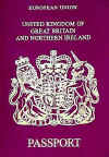
UK Passport


|
World |
|
Atlas |
||
| United Kingdom | ||||
| Contents | ||||
|
|
||||
| General | ||||
| Capital: | London | |||
| Population: | 59,647,790 | |||
| Languages: | English, Welsh, Gaelic | |||
| National Days: | 23rd April (England), 30th November (Scotland), 1st March (Wales) | |||
| Head of State: | Anthony Blair | |||
| Geographic | ||||
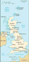
| Location: | Western Europe, islands including the northern one-sixth of the island of Ireland between the North Atlantic Ocean and the North Sea, northwest of France. | |||
| Geographic Coordinates: | 54 00 N, 2 00 W | |||
| Area: | total:
244,820 sq km land: 241,590 sq km water: 3,230 sq km |
|||
| Border Countries: | Ireland | |||
| Climate: | temperate; moderated by prevailing southwest winds over the North Atlantic Current; more than one-half of the days are overcast | |||
| Terrain: | mostly rugged hills and low mountains; level to rolling plains in east and southeast | |||
| Elevation Extremes: | lowest
point: Fenland -4 m highest point: Ben Nevis 1,343 m |
|||
| Natural Hazards: | Some flooding and weak isolated Tornados. | |||
| c | ||||
| Economic | ||||
| GDP: | $1.36 trillion | |||
| Debts: | None | |||
| Currency: | Pound Sterling | |||
| Currency Code: | GBP | |||
| Rough Exchange Rates: | US
Dollar 0.6
Euro |
|||
| c | ||||
| Historic | ||||
| 827 | Egbert becomes first King of all England | |||
| 1066 | England conquered by Normans | |||
| 1274 | Dynastic Union of England and Wales | |||
| 1535 | Legal Union of England and Wales | |||
| 1541 | Henry VIII declared King of Ireland | |||
| 1603 | Dynastic Union of England and Scotland | |||
| 1649 | England declared a Commonwealth | |||
| 1654 | England and Scotland Reunited | |||
| 1660 | Monarchy Restored | |||
| 1707 | Parliamentary Union of England and Scotland | |||
| 1801 | Parliamentary Union of England and Ireland | |||
| 1914-1918 | World War I | |||
| 1921 | Union with Ireland Dissolved | |||
| 1939-1945 | World War II | |||
| 1966 | England Win World Cup | |||
| c | ||||
| Map | ||||
|
|
||||
| c | ||||
| Related Articles | ||||
|
||||
| Archived Media | ||||
 |
 |
 |
||
|
United Kingdom Flag |
UK Passport |
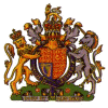
EU Flag | UK Coat of Arms | |
 |
 |
 |
 |
|
| Political Map | British Commonwealth | UN Flag | Physical Map | |
| c | ||||